
Meridian MS80
Handheld LiDar Scanner
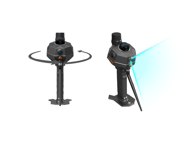
MS80 integrates a high-precision LiDAR, three wide-angle color cameras, an WIFI module, and a 2W radio into one device. It is ready to use right out of the box, enabling a single operator to complete full-scenario scanning. Powered by a brand new point cloud algorithm, the MS80 achieves hardware level synchronization and pixel level fusion of multi-modal sensors, removing the “professional barrier” from high accuracy 3D reconstruction. It is truly lightweight, portable, precise, efficient, and delivers scan-as-you-go performance.

Real-Time Point Cloud Preview
See exactly what you’re capturing in real-time 3D on your phone while you scan. You’ll immediately see any spots you missed, just scan them again right away. No missing parts, no coming back later.


Efficiency Redefined | 1:1 Workflow
With up to 1:1 scan-to-processing ratio, MS80 improves efficiency by 60% compared to traditional solutions, significantly shortening project timelines and enabling faster data delivery
Capture More in One Scan
Triple-eye cameras deliver a 300° × 101° ultra-wide field of view, combined with a LiDAR FOV of 360° × 59°, creating panoramic-level coverage that significantly improves data acquisition efficiency and minimizes redundant scanning.

Meridian Lidar GO V3.0
Meridian Lidar GO V3.0 – Command center in your palm. Real-time HD full-color point clouds on your mobile, no complex setup. Scan as you walk, review as you scan – eliminate return visits.
Meridian Lidar Studio
Meridian Lidar Studio – Data processing center, one step ahead. Powered by a new algorithm tailored for MS80, it delivers a seamless one-stop workflow: from import to export, registration, noise reduction, color fusion, and coordinate transformation in one go. Ideal for indoor decoration, forestry, digital asset capture. Post-processing as simple and fast as scanning.

Technical Specification
| Category | Specification | Details |
|---|---|---|
| System | RTK Performance | 0.8 cm + 1 ppm (H) 1.5 cm + 1 ppm (V) |
| Processing | Real-time processing PPK | |
| Channel | 1408 | |
| BDS | B1I, B2I, B3I, B1C, B2a, B2b* | |
| GPS | L1C/A, L1C, L2P(Y), L2C, L5 | |
| GLONASS | L1, L2, L3* | |
| GALILEO | E1, E5a, E5b, E6* | |
| QZSS | L1C/A, L1C, L2C, L5, L6* | |
| SBAS | L1, L5* | |
| NaviC (IRNSS) | L5 | |
| Frequency | 410-470 MHz | |
| Channel Spacing | 25 kHz | |
| Protocol | SOUTH, TRIMTALK 450S, TRIMMK III, TRANSEOT, SATEL, MERIDIANLINK | |
| Air Baud Rate | 9600, 19200, 11000 | |
| Software | Point Cloud Thickness | ≤1 cm |
| Accuracy | Absolute Accuracy ≤ 5 cm; Relative Accuracy ≤ 1 cm | |
| Mobile App | Supports preview of color point clouds, Android compatibility | |
| Processing Software | Supports spatially correlated viewing of point clouds and panoramic photos | |
| Environment | Robustness | Designed for indoor and outdoor use |
| Operating Temperature | -10℃ to 40℃ | |
| IP Rating | IP54 | |
| LiDAR & Imaging | Camera | 3 × 2 MP Global Shutter RGB Cameras |
| Camera FOV | Horizontal 300° | Vertical 101° | |
| Laser Class | Class 1 / 905 nm | |
| LiDAR FOV | Horizontal 360° | Vertical -7~52° | |
| Point Measurement Rate | 200,000 pts/sec | |
| Frequency | 10 Hz | |
| Range | 40 m @ 10% reflectivity / 70 m @ 80% reflectivity | |
| Physical & Electrical | Weight | 1.38 kg with battery |
| Size | 317 × 117 mm | |
| Battery | 3300 mAh | |
| Input | 14.4 V | |
| Charging | Type-C, PD Fast Charge | |
| Data Transfer | Format | .bin, .txt, .asc, .neu, .xyz, .pts, .csv, .las, .laz, .e57, .sbf, .ply, .vtk, .dxf, .pcd, .shp, .pov, .pn, .pv |
| Detachable Storage | Built-in SSD 256 GB | |
| Data Transfer | USB 3.0 Type-C | |
| Operation | Support MagSafe stand for mobile devices. Support surveying pole connection. |