
Meridian M10
IMU-RTK GNSS
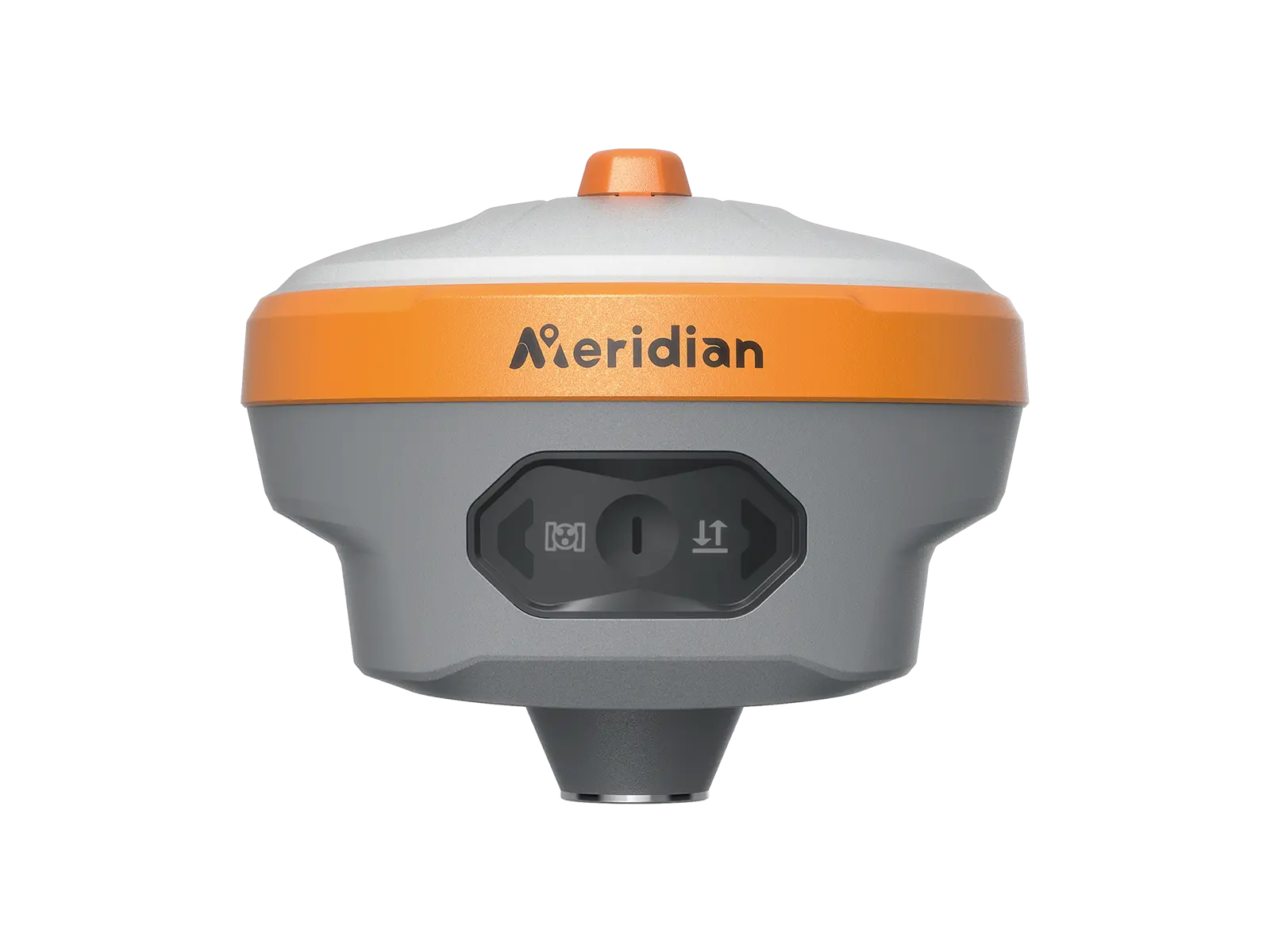
M10 GNSS receiver is a full-featured, intelligent GNSS receiver system equipped with an integrated full-frequency antenna and an advanced multi-channel RTK engine, featuring a built-in radio and 8GB internal storage, allowing users to attain accurate and reliable solutions. Its powerful RTK algorithm makes M10 easy to get fixed solutions in the most demanding environments, brings you to focus on your surroundings and not the bubble to measure the points that previously could not be measured, making your stake out more efficiently and conveniently than ever before with increased speed, safety and comfort and greatly improving your working efficiency
Multi Constellation
M10 provides an excellent onboard real-time navigation solution with high accuracy. Multi-satellite signals (GPS, GLONASS, BEIDOU, GALILEO, QZSS, IRNSS, L-Band) are included.


Powerful IMU Feature
Equipped with 120° calibration-free IMU technology in a small body, extending the M10 application range to locations that traditional RTK systems cannot reach, opening up new horizons for product applications.
Longer Working Distance
The upward-facing radio antenna allows 30% longer working distance, ensures superior satellite acquisition and a stable signal lock.

Powerful Batter
With 7.2V 6600mah and the quick-charge capability, supports you in working more than 26hours and greatly saves your time.
Rugged Housing
IP68 waterproof and dustproof design and magnesium-aluminum alloy housing.

Technical Specification
| Category | Specification | Details |
|---|---|---|
| GNSS Signal | Channel | 1760 (1980 option) |
| BDS | B1I, B2I, B3I, B1C, B2a, B2b* | |
| GPS | L1 C/A, L1C, L2P(Y), L2C, L5 | |
| GLONASS | L1, L2, L3* | |
| GALILEO | E1, E5a, E5b, E6* | |
| QZSS | L1C/A, L1, L2, L5, L6* | |
| SBAS | L1, L5* | |
| NavIC (IRNSS)* | L5 | |
| L-band | B2b PPP (Only for the Asian-Pacific Region) & HAS* | |
| Data Format | CMR, CMR+, RTCM2.X, RTCM3.X | |
| Data Output | NMEA-0183, RINEX, TXT | |
| Data Updating Rate | Up to 20 Hz | |
| Time to Recapture | <1 s | |
| Cold Start | <40 s | |
| Positioning Performance | Single Point Positioning (RMS) | Horizontal: 1.5 m | Vertical: 3.0 m |
| DGPS (RMS) | Horizontal: 0.4 m | Vertical: 0.8 m | |
| Real-Time Kinematic (RMS) | Horizontal: ±(8 mm + 1 ppm) Vertical: ±(15 mm + 1 ppm) | |
| Speed Accuracy (RMS) | 0.03 m/s | |
| Static Accuracy (RMS) | Horizontal: ±(2.5 mm + 0.5 ppm) Vertical: ±(5 mm + 0.5 ppm) | |
| Time Accuracy (RMS) | 20 ns | |
| Speed Accuracy | ≥0.03 m/s | |
| Tilt Compensation Accuracy | ≤2 cm (Tilt Angle ≤60°, up to 120°) | |
| IMU Update Frequency | 200 Hz | |
| Laser Accuracy (RMS) | Horizontal: ±(8 mm + 3 mm/m) Vertical: ±(15 mm + 3 mm/m) Green laser range: 100 m | |
| Communication | Bluetooth | SPP3.0 + BLE5.0 Dual Mode, 2.4 GHz @ +6 dBm |
| WiFi Option | 802.11 a/b/g/n/ac | |
| Cellular | LTE FDD: B1/2/3/4/5/7/8/12/13/18/19/20/25/26/28 LTE TDD: B38/39/40/41 WCDMA: B1/2/4/5/6/8/19 GSM: B2/3/5/8 | |
| Storage | 32 GB | |
| Internal Radio | Transmitting Power: 2 W (33 ± 1 dBm), 1 W (30 ± 1 dBm) Frequency: 410~470 MHz; Channel Spacing: 12.5 kHz Protocol: SOUTH19200, SOUTH9600, TRIMTALK9600, TRANSEOT, SATEL Air Baud Rate: 9600, 19200, 11000 | |
| Battery | Specifications | 7.4 V, 7000 mAh lithium-ion rechargeable battery |
| Operating Times | RTK base/rover mode: up to 20 hours RTK laser/AR: up to 15 hours Static: up to 40 hours (Typical Power Consumption) | |
| Charging | Support USB PD 15 V / 2 A (supports quick charging adapter) | |
| Environment | Operating Temperature | -40°C ~ +85°C |
| Storage Temperature | -55°C ~ +85°C | |
| Anti-seismic | 2 m pole drop onto concrete | |
| Dust & Waterproof | IP68 | |
| Physical | AR Camera | 12 MP large viewing angle, for live view stakeout |
| I/O Interface | 1 × USB Type-C port; 1 × TNC antenna port; 1 × SIM card slot; 1 × 5 pin LEMO port | |
| Dimensions | 125 mm × 125 mm × 79 mm | |
| Weight | ≤699 g |